
Climate Risk Dataset
High-Resolution Climate Data Series. Gain access to detailed, downscaled daily time series for a variety of climate variables, covering the period from 1980 to 2099.
.avif)
Daily Climate Data Up to a Century Ahead
Data Sources
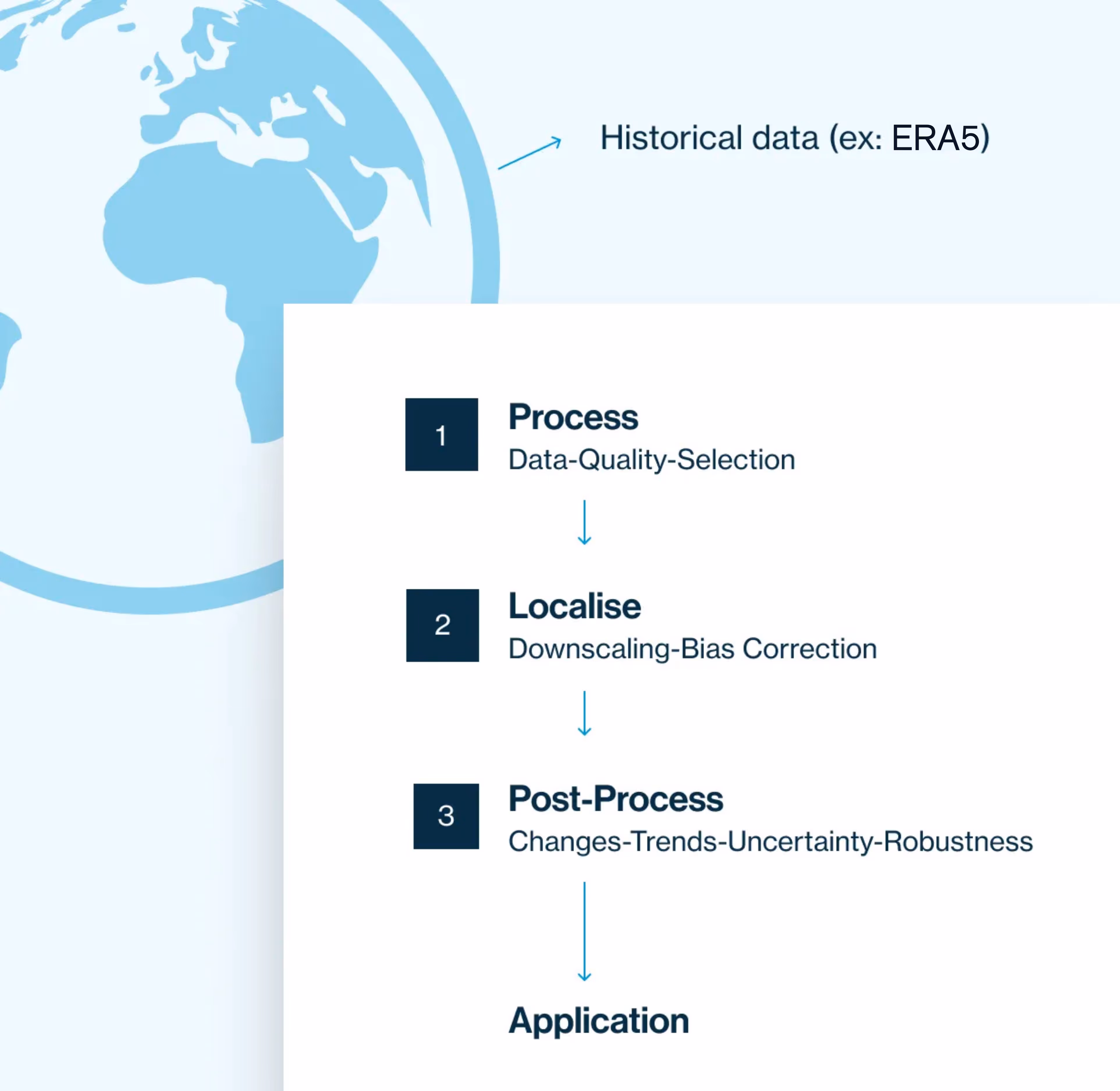
Leverage a comprehensive climate risk dataset that includes ERA5 and Vortex data for historical and real-time climate conditions, along with downscaled Global Climate Models (GCMs) for future climate projections.
By combining these sources, the climate risk dataset provides a complete picture of climate dynamics, from past events to projected long-term scenarios. This integration ensures reliability and consistency, offering a trusted foundation for climate analytics, energy planning, and risk management.
Daily Time Series
Daily time series data from multiple climate models, part of a comprehensive climate risk dataset, covering key variables across wind, solar, water, soil, and temperature categories.
These high-frequency time series allow for in-depth exploration of climate variability and extreme events. With the climate risk dataset, users can conduct detailed simulations, improve forecasting accuracy, and evaluate sector-specific climate impacts with greater confidence.
+20 Climate Models
Data from more than 20 selected downscaled Global Climate Models (GCMs) within a comprehensive climate risk dataset.
The inclusion of multiple GCMs enhances the robustness of the climate risk dataset, enabling comparative studies across different climate pathways. This diversity ensures a deeper understanding of uncertainty, providing users with a wider range of possible outcomes to design resilient strategies.
Resolution and Coverage
Daily data from 1980 to 2099 with global coverage is provided as part of a comprehensive climate risk dataset. The horizontal spatial resolution for each time series is 25 km for general assets and 3 km for wind and solar assets.
With global reach and fine spatial granularity, the climate risk dataset supports decision-making at both strategic and operational levels. Whether analyzing global climate trends or asset-specific vulnerabilities, its detailed resolution makes it a powerful tool for industries, policymakers, and researchers alike.
.avif)
.avif)


